
Trace a Westlake Street Address
A Westlake street directory search is strongest when it follows the Westlake property trail in order. Start with one confirmed Westlake street address rather than trying to produce a street-wide household list. MyPlace can connect a Westlake address to a parcel, deeded owner, legal description, transfers, tax views, and map. That Westlake parcel then gives the Recorder a more precise way to find instruments. Older Westlake address work may need County maps, tax records, and a criss-cross directory that covers Westlake.
- In MyPlace, choose City = Westlake and select Address. Open the matching parcel and preserve the permanent parcel number, property address, deeded owner, legal description, and transfer details.
- Use Transfers or Get a Document List. In Official Records Advanced Search, enter the Westlake parcel with hyphens or use the property address, then narrow with dates and the legal description.
- Read the party roles. The current acquisition may show the owner as grantee and the seller as grantor. Search that seller as an earlier grantee to move backward.
- When the present Westlake address does not resolve an older record, take the parcel and legal description to the Map Room or County Archives for map, tax, appraisal, and atlas context.
- For historic adult-occupant context, check an eligible CPL criss-cross or directory volume. Confirm its title page includes Westlake before using an address entry.
That Westlake sequence separates what each record actually says. It avoids treating a map click, a tax-mailing field, or a single name hit as a conclusion about every person at an address.
Westlake MyPlace Street Search
MyPlace is the County’s current address hub for the Westlake street directory. Select Westlake in City, then choose Owner, Parcel, or Address before typing the known value. A Westlake result can open General Information, Transfers, Values, Land, Building Information, Building Sketch, Other Improvements, Permits, Property Summary Report, Tax By Year, View Map, Full Map, and a document-list handoff. The portal’s combination of Westlake parcel and transfer information is the reason it comes first in an address-led search.
Keep the Westlake property address separate from the tax mailing address. The situs address is the physical parcel location. The tax mailing address is where the taxpayer receives a bill. Neither one alone establishes all people connected to a Westlake address. The Westlake legal description and permanent parcel number link the tax, deed, and map systems, which makes them more useful when a street label or format changes.
| MyPlace control | Street-directory use |
|---|---|
| City | Choose Westlake before a County search. |
| Search By | Use Owner, Parcel, or Address as the starting mode. |
| View Map / Full Map | Zoom and click an individual parcel for a separate property record. |
| Transfers | Review sale and party information before moving to the deed index. |
| Tax By Year | Open current and prior bill views, available payment history, and balance. |
| Get a Document List | Move from a parcel to recorded-document research. |
MyPlace is a free public compilation. The underlying office record and the recorded instrument remain the places to verify important property information.
Westlake Street Records by Address
Westlake address-keyed sources do not all serve the same purpose. Current Westlake parcel information belongs with the Fiscal Officer. Westlake recorded documents establish parties, dates, and legal instrument references. City Planning material can supply Westlake public project context. County Archives can supply older Westlake maps, taxes, and appraisal records. The public voter form does not provide a by-street list, so it cannot fill the gap between a parcel owner and a claimed household.
| Westlake address record | Keeper | What it can show | Access route |
|---|---|---|---|
| Current parcel/property record | Cuyahoga Fiscal Officer | Parcel, deeded owner, site address, land use, legal description, transfer, values, and map | MyPlace |
| Tax bill/history | Treasurer through Fiscal Officer | Current or prior bill, available payment history, and balance | MyPlace Tax By Year |
| Recorded document | Transfer & Recording | Parties, roles, dates, document number, parcel, address, legal description, and available image | Official Records Search |
| Planning project | Westlake Clerk of Commissions | Address or project-name planning material, minutes, plans, and development context | OnBase PLAN |
| Historic property layers | Cuyahoga County Archives | Maps, tax records, appraisal cards, and suburban atlases | Appointment |
The Westlake parcel number and legal description are the links across these systems. A Westlake street name supplies orientation, but it is not the durable key for each older map or deed reference.
Westlake Recorder Address Chain
The Recorder’s Westlake data reaches from 1810 to the present, according to Cuyahoga County. Advanced Search accepts Party Names, Grantor or Grantee, recorded and instrument date ranges, document numbers, parcel ID, volume or page, property address, document-image text, subdivision, and legal-description controls. Use the Westlake address to find candidates, then use the parcel and legal description to test them. The interface supports indexed and OCR image-text routes, but the County says to search manually and verify Westlake results.
For a Westlake deed sequence, record the document number, dates, seller, buyer, parcel, and legal description from each likely instrument. The buyer in a current transaction may become the seller in a later one. Repeat the Westlake search using the prior owner as grantee when looking for the earlier acquisition. This creates a Westlake address history from records, rather than from a broad name match.
Cuyahoga’s Advanced Official Records Search shows the address, parcel, role, date, and legal-description controls used for this part of the Westlake street directory.
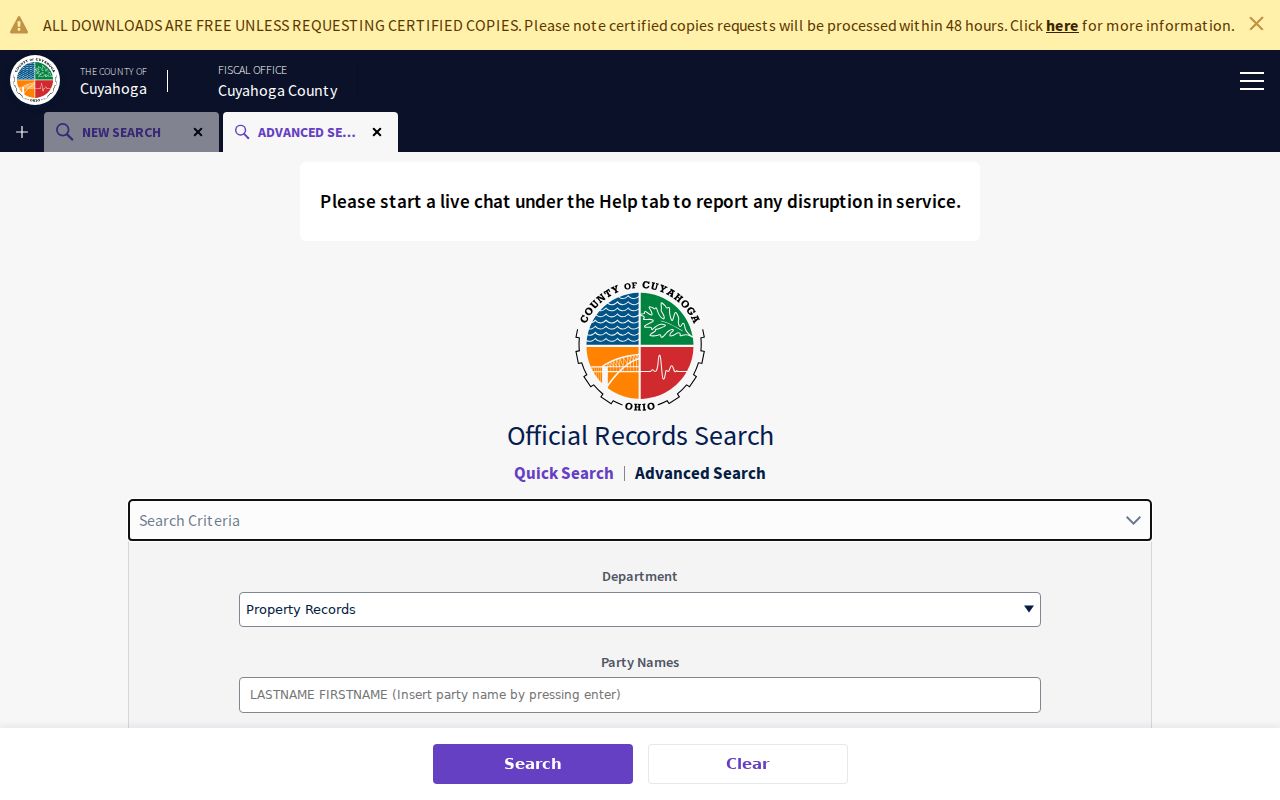
The document index may supply a Westlake image route, but image availability is portal-dependent. Treat an index entry as a reference to be checked, not as a title conclusion.
Westlake Parcel Number Quirk
Cuyahoga’s permanent Westlake parcel number is built from map-book, map-page, and parcel coordinates. The County displays it as 000-00-000, while the City gives a Westlake example formatted 212-01-003. This number connects Westlake land records that otherwise use different labels. It is a useful Westlake street directory key because it follows the physical parcel through tax, map, and recorded-document work.
The number is stable only while the Westlake physical boundary is unchanged. A split or combination can create a new parcel situation. That is why the Westlake legal description should travel with it. When an old Westlake street name or dimension no longer matches a current address, ask the Map Room or Archives to help compare the parcel, description, and historic map evidence instead of relying on the present house number.
Note: A permanent parcel number identifies land-record geography, not a person or a complete list of people at an address.
Westlake Map Click Limits
MyPlace View Map and Full Map support a simple, documented Westlake method: zoom to the known address and click one parcel to open that parcel’s information. Cuyahoga GIS confirms Westlake parcel geometry and property characteristics. This is useful for checking the next individual parcel along a Westlake street, but the accessible public material did not establish a whole-street list, a radius tool, or an exhaustive public layer menu.
Adjacent Westlake parcels do not necessarily mean a shared building, a full block, or every person linked to the area. The map is strongest for Westlake parcel boundaries, legal-description context, and a sequence of separate property records. Use the owner, transfer, and document trail from each selected parcel instead of reading a parcel display as a household directory.
Westlake’s maps and GIS page supplies the City’s address-enabled political map and its local parcel-number explanation.
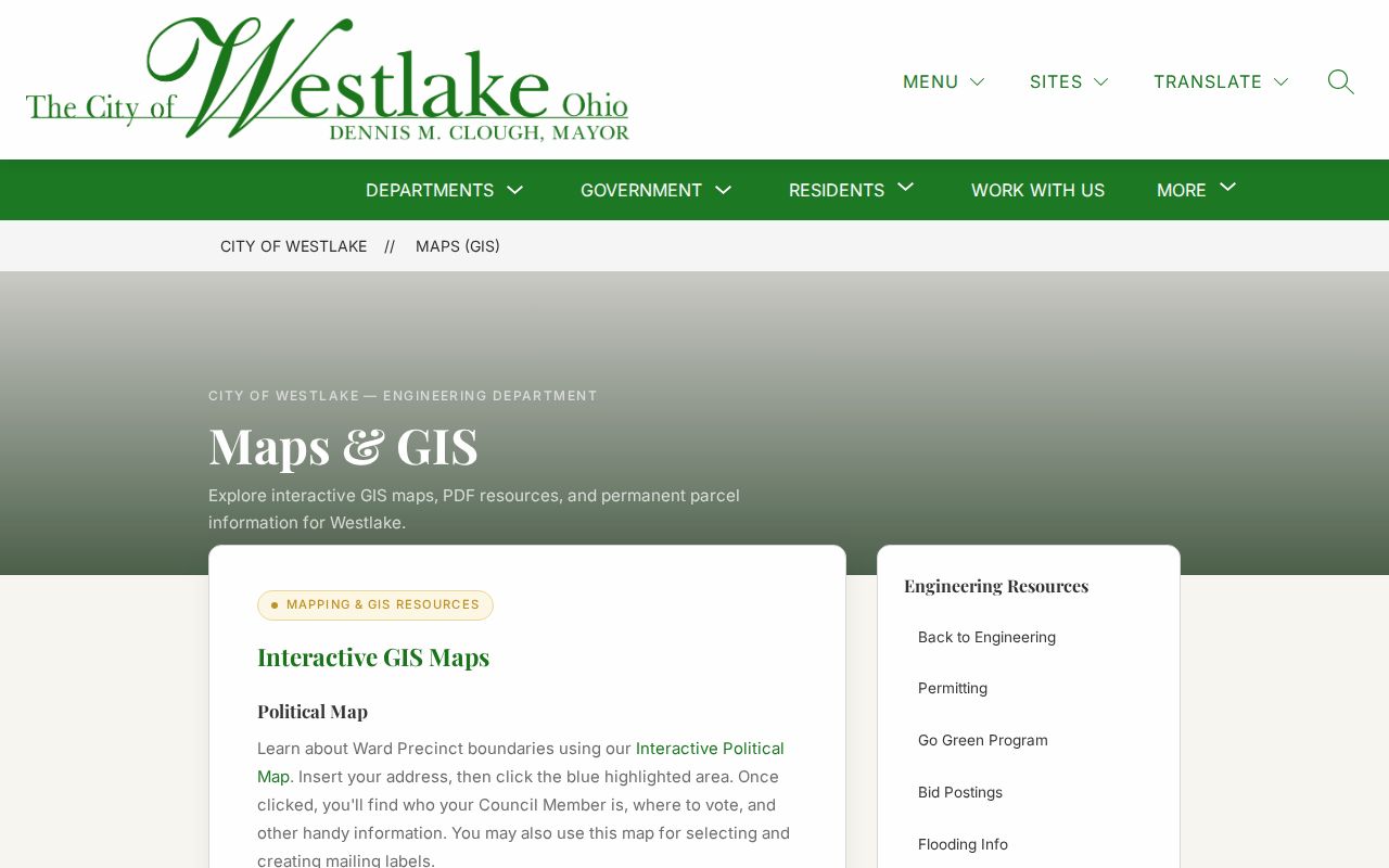
The City political map uses an entered address to identify a Council member and voting location. It is a location tool, not a source of household membership.
Westlake Planning Address Context
Westlake OnBase Public Access adds a municipal layer to a Westlake street search. Its documented CNL route holds Council and committee material. The PLAN route holds Planning Commission material that the City says can be researched by Westlake address or project name. A Planning result can include pending or approved projects, archived minutes, plans, site drawings, lot splits, subdivision, zoning, and development context. It documents a public Westlake municipal process, not a list of people who live nearby.
The Westlake City Building route is changing. The former eGovPLUS page exposed login and account activation, while the City announced that IMS would go live in August 2026 with some guest public-record and contractor functions. The exact guest field list was not verified. Call the Westlake Building Department when a permit or inspection question requires a current field-level search procedure.
Westlake OnBase Public Access is the source for the CNL and PLAN routes.
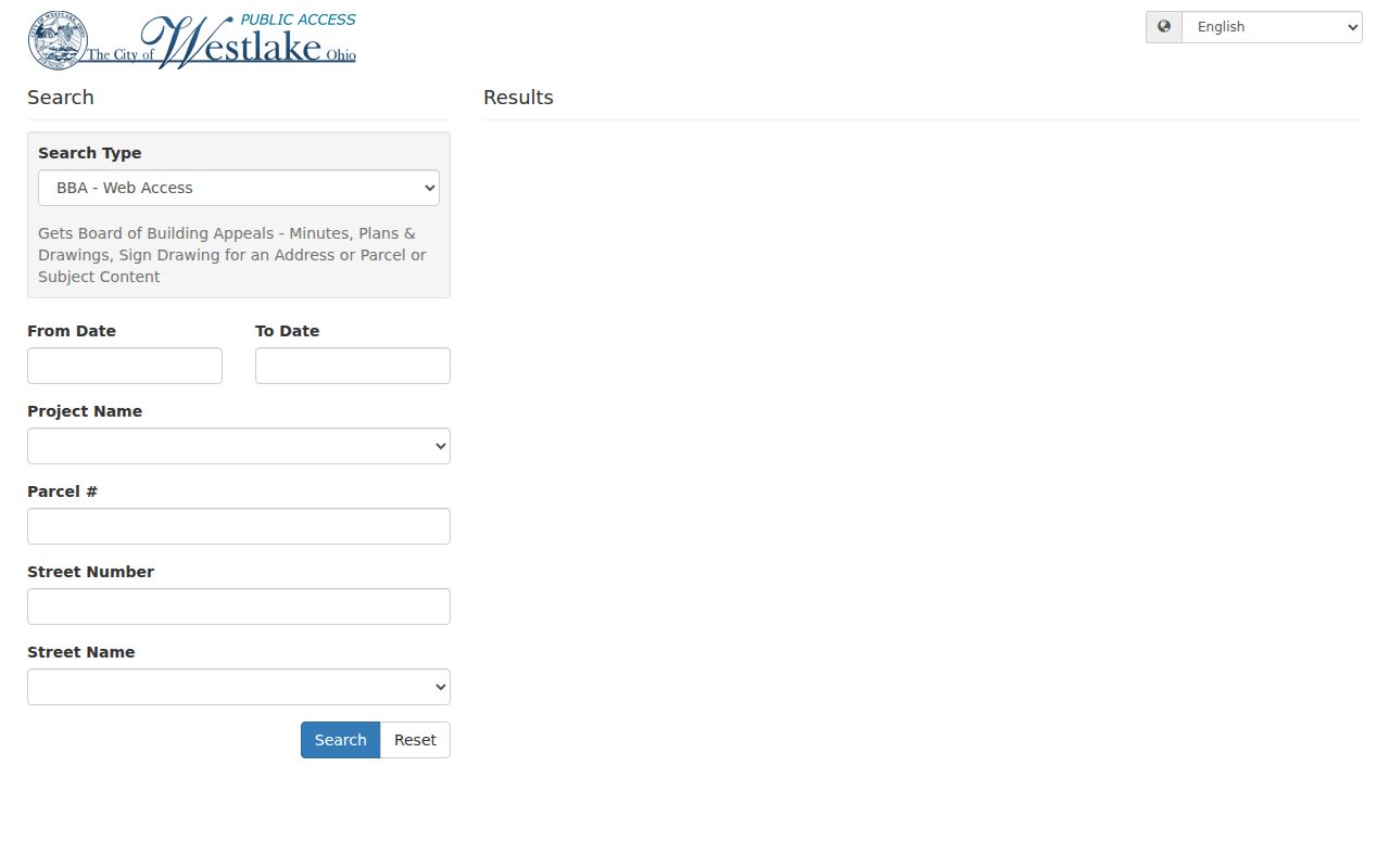
Use the address or project name as the City documents, then compare the Planning material with the County parcel and recorded-document trail.
Westlake Street Voter Limits
Ohio My Voter Information is a first-name, last-name, and County verification form. Use Cuyahoga County for a Westlake registration or precinct question. The form may offer a Street Name selector only after a Westlake name search is narrowed. It does not provide a public Westlake address-first or whole-street voter directory. Ohio’s official daily snapshots are a broad state file route, not a built-in replacement for the one-person form.
Protected fields and confidential registrations stay out of the public Westlake result. Ohio law protects identifiers and certain addresses, including Safe at Home participants and qualifying protected public-service workers. Westlake voting history is an election participation record, not a display of ballot choices. If a person believes a Westlake registration should appear, the defensible next step is the Board of Elections, not a claim based on an absence.
Ohio My Voter Information is the documented individual registration and precinct channel.
Dover in Westlake Street Records
Older Westlake street directory work must use the predecessor names Dover Township and Dover Village. Dover Township was incorporated in 1811, Dover Village in 1911, Westlake Village in 1940, and the City in 1957. Historic Westlake maps, directories, newspapers, civic minutes, and archive references may use Dover even when a current parcel is in Westlake. Search all applicable Westlake place names before deciding that an address trail has stopped.
Westlake Porter Public Library says existing Dover Township Trustee minutes cover 1831 through 1893. City Council minutes and legislation cover 1910 to the present. The documented OnBase instruction is to choose CNL and enter Dover Township Trustees or Council as Meeting Type. Roads, lot references, local government actions, and place names in those minutes can make a historic parcel record easier to interpret.
Westlake Address Records Compared
A Westlake address produces a different answer in each property system. MyPlace is the current parcel compilation and offers a convenient transition from an address to a parcel. The Recorder has the legal recorded document and indexed party roles. The Archives supplies the older map, tax, appraisal, and atlas layers. This comparison matters when a present address does not line up cleanly with an older description.
| Address source | Primary answer | Important limit |
|---|---|---|
| MyPlace | Current parcel, deeded owner, transfers, tax, property, and map information | It is a public compilation, not the official deed itself. |
| Official Records Search | Recorded parties, dates, instrument, parcel, address, and legal description | Index or image access is not a title opinion. |
| Map Room | Parcel structure, tax-mailing explanation, and current or prior owner assistance | Use counter help when a parcel will not resolve online. |
| County Archives | Historic maps, tax records, appraisal cards, and atlases | Property research is by appointment. |
The Recorder’s current property-alert service is for registered names or a property description or address. It is an alert mechanism, not a guarantee against a problem and not a general street-search function.
Westlake Street Directory History
Historic address-to-name work uses directory volumes and criss-cross sources only when their geography includes Westlake. Cleveland Public Library documents a 1953 Fairview Park, Parkview, North Olmsted, Westlake Directory; Lakewood volumes with Westlake included beginning in 1958; and a West Suburban run after 1964. Haines Criss-Cross has early 1923 and 1926 material, then a 1960-to-last-year run, subject to coverage. A title page remains the first check.
Directory entries can provide a past adult-occupant layer. The address section may associate an address with adult names, and Haines normally shows name, address, and telephone. Pair that result with deeds, tax maps, probate, and census releases. It is not proof of ownership or a complete resident list. The collection years and reading method are detailed in the Westlake city directory materials.
For older parcel context, Cuyahoga’s Map Room information explains the permanent-parcel format and prior-owner research help.
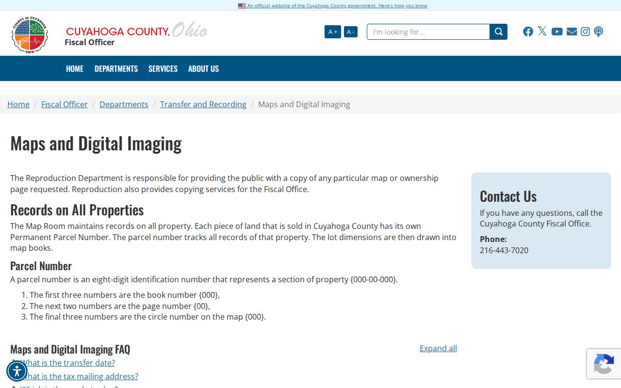
The Map Room is a documented fallback for a Westlake address that needs parcel, map, or prior-ownership interpretation beyond the public screen.
Westlake Street Directory Boundaries
A Westlake street directory can trace public property and civic records by address. It cannot create a verified list of every person at a property. A parcel owner is not every resident. A tax mailing address is not necessarily a physical location. Private utility and delivery lists are not public, and driver address information has separate legal protection. The City and County did not publish a verified list of every person along a Westlake street.
Ohio Safe at Home, confidential voter treatment, protected-worker address redaction, restricted court files, and field-level vital limits can change what appears online. Use the relevant custodian for a record correction or official copy. A narrow City public-record request can seek qualifying municipal material by address, project, record type, and date range under the Ohio Public Records Act.
For an older address that needs map and tax records, Cuyahoga County Archives property research is the documented appointment route.